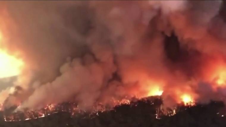
Australia’s wildfires, unprecedented in their size and severity, are so intense they are setting off a series of bizarre phenomena, including fire-driven thunderstorms, fire clouds and so-called ember attacks.
Though rain brought some much-needed relief to Australia’s east coast Monday, officials say the wildfire risk remains high, with forecasts showing that conditions will likely dry out and temperatures will creep up again later this week, adding fuel to more than 130 fires that are burning around the country.
Smoke from the fires is still affecting air quality and visibility across New South Wales and the neighboring state of Victoria, according to Australia’s Bureau of Meteorology, but emergency crews are working to clear roads and restore power to affected communities during the respite.
“Priority today and over the next few days is to turbocharge the recovery process,” New South Wales Premier Gladys Berejiklian tweeted Monday.
Let our news meet your inbox. The news and stories that matters, delivered weekday mornings.
But Australia is not yet in the clear. Prime Minister Scott Morrison, who has faced harsh criticism for not addressing the link between the country’s wildfires and climate change, warned that the fires will continue to burn for months to come. The New South Wales Rural Fire Service reported that there are still 69 uncontained fires in that state alone, many of which remain severe.
“There are places where flames have been 70 meters [230 feet] high, and there’s evidence in some places that temperatures of the fires have been 1,000 degrees [celsius],” said Sarah Perkins-Kirkpatrick, a climate scientist at the Climate Change Research Centre at the University of New South Wales in Sydney.
These “intense and voracious” fires are interacting with the atmosphere and creating their own weather, including lightning, which can cause new wildfires, she added.
Fire-driven thunderstorms have been observed before, and typically occur when columns of smoke and heat draw in moisture from the atmosphere and create an enormous pyrocumulonimbus, or “fire cloud.”
According to the Bureau of Meteorology, these dangerous formations can spread fires by driving strong winds, generating lightning and lofting burning fragments — a phenomenon sometimes called an ember attack.
Dramatic footage captured Jan. 1 by firefighters in New South Wales showed an ember attack that pelted the firetruck with sparks and trapped the emergency crew in a so-called flashover.
Fire clouds also funnel smoke and tiny particles known as aerosols into the lower stratosphere — similar to what happens when a volcano erupts — which can affect air quality.
The U.S. National Oceanic and Atmospheric Administration reported Monday that one of its Earth-watching satellites spotted smoke from the Australian fires drifting over South America. And over the weekend in New Zealand, the skies turned a haunting orange hue as wildfire smoke crossed the Tasman Sea and wafted over the North Island.
Though the impact of climate change on fire clouds is still a nascent field of research, scientists are concerned that climate change could make fire-induced storms more common, particularly as global warming drives more intense wildfires.
Researchers are also studying the impact that pyrocumulonimbus clouds can have on the climate. A 2018 study published in the journal Climate and Atmospheric Science found that the amount of aerosols lofted into the atmosphere from fire clouds is equivalent to a moderate-size volcano eruption.
"how" - Google News
January 07, 2020 at 04:36AM
https://ift.tt/35x18Ro
Fire clouds and ember attacks: How Australia's fires are creating rare weather phenomena - NBCNews.com
"how" - Google News
https://ift.tt/2MfXd3I
Bagikan Berita Ini


0 Response to "Fire clouds and ember attacks: How Australia's fires are creating rare weather phenomena - NBCNews.com"
Post a Comment